Biodiversity of the Los Angeles River Dashboard
Links
Project Details
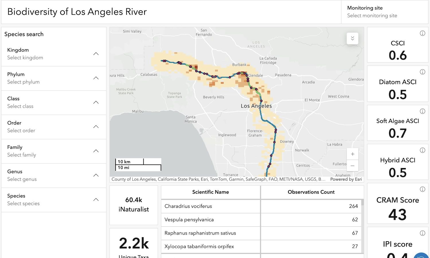
This project is an ArcGIS Dashboard about the Biodiversity of the LA River.
The dashboard shows information about iNaturalist observations along the LA River and biodiversity scores from the Los Angeles River Watershed Monitoring Program (LARWMP). Users can search for taxa and LARWMP monitoring stations. The taxa counts and biodiversity scores are updated as users interact with the map.
Data Sources
- iNaturalist data from GBIF.org
- Boundaries for LA River and soft-bottom areas from LA River Master Plan
- Parks data from County of Los Angeles
- Biodiversity scores from Los Angeles River Watershed Monitoring Program (LARWMP)
Pasadena City College Course
GEOG 115 Environmental Analysis with GIS
Tech Stack
- ArcGIS Pro
- ArcGIS Dashboard